Trails
Scenic Hikes in the Ozarks
Take in the sprawling vistas and gorgeous bluff-side views along the meandering trails that wind through the Ozarks, from quick half-day treks on Springfield paths to trips that can span a short weekend away.
By Sony Hocklander
Nov 2021
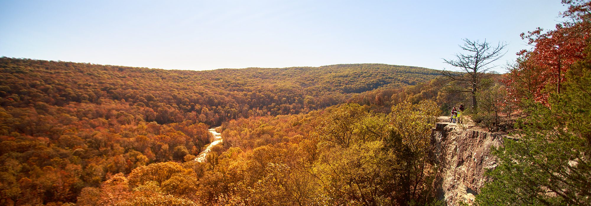
Take in the sprawling vistas and gorgeous bluff-side views along the meandering trails that wind through the Ozarks. From quick half-day treks on Springfield paths to trips that can span a short weekend away, we found 10 hikes for every interest and level of experience. Use this guide to get out there and start exploring. Keep reading or pick a trail below.
Choose a Trail

Frisco Highline Trail
It’s likely you’ve done the enjoyable Frisco Highline Trail between the Springfield trailhead and where the pavement ends in Willard. But if you haven’t done the trail north of Walnut Grove, you’re missing out on a historic and nature-immersive experience. This is where a series of 16 historic railroad bridges begin; many inspiring a stop and a photo. We suggest doing a 7—to—8.75-mile section of the trail that features up to eight bridges. On the trail map, this runs from the Walnut Grove trailhead (at Mile 16) as far as the Wishart Trailhead (at roughly Mile 24). The best view (also a turnaround option) is at the Little Sac River from the picture-worthy, 270-foot long railroad bridge built in 1884. From either side of the bridge you get tree-framed vistas of the slow-moving river far below. You might even see floaters going by.
The series of historic bridges start at Mile 18.25 with the 68-foot Hobo Haven Bridge, followed by the 55-foot Eudora Bridge (Mile 19.25); the 84-foot Venable Spring Bridge (Mile 21.25); the 40-foot Revis Bridge (Mile 21.75) and the Little Sac River Bridge (Mile 22.5). Continue past the Little Sac River to cross the 15-foot Quarry Rock Bridge (Mile 23.75); the 41-foot Dutton Bridge (Mile 24) and the 193-foot Wishart Bridge at Mile 24.75 near the trailhead.
If you plan a roundtrip trek on foot or bicycle, you should know the trail decreases in elevation north of Walnut Grove. It’s so subtle at times you feel like it’s level – until you start the long slow uphill climb back to your car. It’s 16-plus miles roundtrip to Wishart and back; roughly 14 miles if you turn around at the Little Sac River Bridge. If you do the trail with kids or have friends to help shuttle, consider dropping a car at the Wishart Trailhead, then drive back to Walnut Grove for an easy, scenic downhill trek that’s about 8.75 miles one way.
Difficulty: Easy (but long)
Length: 8.75 miles one way between the Walnut Grove and Wishart trailheads
Location: 30 miles northwest of Springfield at Walnut Grove
Time commitment: Half-day
Kid friendly: Yes
Dog friendly: Yes

Yellow Trail
Busiek State Forest and Wildlife Area is so convenient from Springfield, it’s an easy way to seek fall color, take a tromp through the woods and get a big sky view overlooking Ozarks forestland. With roughly 18 miles of trails named for colors of the rainbow, what are you waiting for?
For some of the best valley views and interesting things to see, we like the Yellow Trail on the park’s east side. The crisscrossing trails can get confusing so take a map or download a trails app to keep track of your journey. Also bring your sticks and wear waterproof boots. The trails have sections of rocky terrain and there are several creek crossings.
To hike the Yellow Trail, cross a bridge over the creek and start following the path until you come to a fork. Go left to hike the loop clockwise. This takes you most quickly to see the Carter Family Cemetery – a pretty yucca plant-filled landmark where headstones date back to the 1800s. After exploring the cemetery, continue past a pond and some fire rings to eventually encounter the Yellow and Red Trail junction. For a shorter hike, you can take the fork left onto the Red Trail loop and hike that around back to the parking lot. Otherwise, continue along the Yellow Trail and soon you’ll come to a scenic overlook—colorful in the fall. The trail continues to another junction which, if taken to the right, is a Yellow Trail loop shortcut that gets you back more quickly. If you’re game, do the full loop for a more vigorous trek. If it’s been rainy, you might also look for the elusive wet-season waterfall on the far side of the Yellow Trail that only runs after a good soak.
Difficulty: Moderate
Length: 4.3-mile loop
Location: 30 minutes south of Springfield off U.S. 65.
Time commitment: Half-day
Kid friendly: Yes, though may be more suited to older kids
Dog friendly: Yes, on a leash.
Natural Tunnel Trail
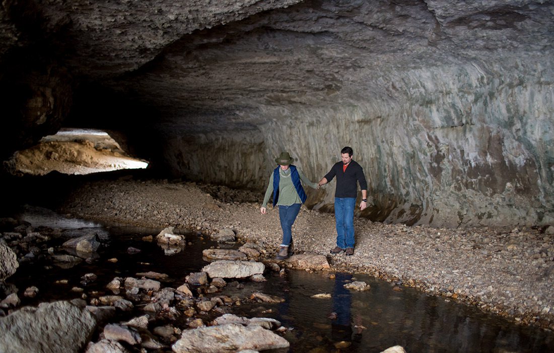
Bennett Spring State Park isn’t just for anglers, or a home base for floaters. The pretty park offers plenty of reasons to explore and includes several trails. It’s signature trail leads to a 296-foot-long natural tunnel with a gravel creek bed that curves through a hill. Tall enough to easily walk through, this unique geologic feature was carved out by water through dolomite. A creek runs through the tunnel but there are gravel edges to walk along the side. After a rain, you might find a little run-off from tunnel roof.
The trail is family-friendly for kids old enough to handle its length, rocky terrain and occasional creek crossings. Spray for ticks in warm weather and wear footwear that can get wet in the tunnel and creeks as you cross – some of which can get deep in rainy seasons. Consider taking a small flashlight to illuminate the deepest parts of the tunnel.
The main portion of the Natural Tunnel Trail is a semi-loop, with an out-and-back spur from the loop to reach the tunnel. It features a variety of interesting natural elements, passing through Spring Hollow and along bottomland. It goes through upland forests and sunny glades. And it features tall bluffs, small and large streams, old farm fields and, especially along the tunnel spur, interesting geologic formations including small caves. You’ll also pass an old cemetery dating from the 1800s where two families from the area are buried. All in all, this trail is a great way to enjoy the outdoor Missouri Ozarks.
Difficulty: Moderate
Length: 8.6-mile semi-loop
Location: A little more than 1 hour northwest of Springfield inside Bennett Spring State Park.
Time commitment: Half to full day
Kid friendly: Yes, although it’s long
Dog friendly: Yes, on a leash.
Pedestal Rocks Loop Trail
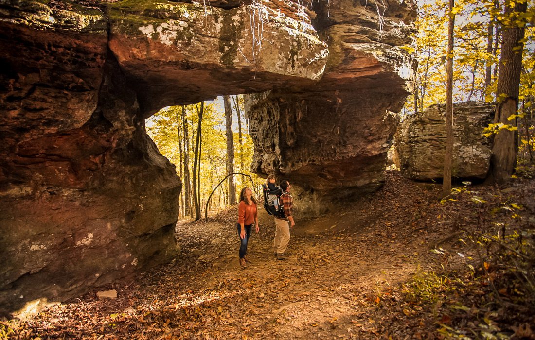
The Arkansas Ozarks mountain region is chock full of interesting rock formations and caves, and the Pedestal Rocks Loop Trail showcases the best against a backdrop of broad valley views. One of two hikes in the Pedestal Rocks Scenic Area, the trail is easy to reach with generous parking off Arkansas State Highway 16 near Pelsor (about 35 miles south of Jasper).
For the best views of pedestals—tall breakaway rock formations that mushroom into large tops—hike when trees are bare, or nearly so, in late fall through early spring. Start the hike by taking a short spur from the parking lot. At an intersection, continue forward (the righthand path) to hike the loop counterclockwise. After some easy switchbacks, you’re close to the bluffs and the first pedestals.
As you follow the bluff line, look for off-trail shoots to get closer views of pedestals, outcroppings and beautiful broad valley views. As you continue along the trail, watch for an area to scramble down to the base of bluffs to explore caves, crevices and tall bluff formations from a different perspective—one of the best things about the hike. Back on the trail, you’ll wind along blufftops where spectacular views open even further. One of the last rock formations before the trail starts looping back is a natural bridge. Go off-trail to explore a bit if it’s not too overgrown.
If you have time, also do the 1.7-mile King’s Bluff Loop which takes hikers to a huge stone bluff with a scenic overlook. In wet seasons, a waterfall flows over the north side. Caution: The bluff has a railing but can be slick in wet seasons. If considering a hike with kids, these trails may be more suitable for older ones with hiking experience, given high bluffs and areas with cracks in the rocky ground.
Difficulty: Moderate
Length: 2.5-mile loop
Location: 2 hours and 40 minutes south of Springfield near Pelsor, Arkansas.
Time commitment: Make it a day trip
Kid friendly: Yes, with caution due to high bluffs; may be more suitable for older kids with hiking experience
Dog friendly: Yes, on a leash; use caution due to cracks in rocks.
Whitaker Point Trail
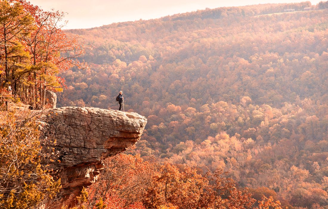
Whether you spend a weekend in the upper Buffalo National River region of Arkansas, or plan a day hike, the Whitaker Point trail is a must-do for many. The well-traveled out-and-back trail, which is also knowns as Hawksbill Crag, starts mostly downhill through a pretty forested area with interesting rock formations and an easy creek-crossing.
The payoff for this trail is the picture-worthy outcrop and incredible view of the Whitaker Creek valley stretching to the horizon. Once you reach the cliff area, pause at a bluff for the best view of the iconic hawk-shaped rock. Once you reach Hawksbill Crag, you’ll find its surface is surprisingly larger than appears from a distance. It’s possible to walk out for views and photos without standing right at the edge. Back on the trail, go just beyond Hawksbill to another cool rock formation for another view.
The trailhead is located on Cave Mountain Road, a roughly 6-mile gravel road that includes a steep incline. There is a small parking area across from the trail; on busy weekends, cars may line the roadside. While the trail itself may be kid-friendly for experienced young hikers—even with the more challenging uphill hike back to cars—use extreme caution near the bluffs.
Some hike this trail early to catch the sunrise; others wait until sundown for a valley glow. You may find early morning fog fills the valley, slowly dissipating as temperatures warm. If there has been wet weather, take the spur at a trail intersection to see Upper Haley Falls. Try going during the week or start early morning to encounter fewer hikers. Otherwise expect company on this trail, especially when colorful fall leaves are at their peak.
Difficulty: Moderate
Length: 2.9 miles out and back
Location: 2 hours and 45 minutes south of Springfield in northwest Arkansas.
Time commitment: Make it a day trip
Kid friendly: Yes, with caution due to high bluffs; may be more suitable for older kids with hiking experience
Dog friendly: Yes, on a leash.
Yellow Rock Trail
Devil’s Den State Park in Arkansas is a weekend-worthy destination. A prime example of 1930s construction by the Civilian Conservation Corps (CCC), the park features an assortment of trails, a lake, pool, cabins, campsites and even a little store.
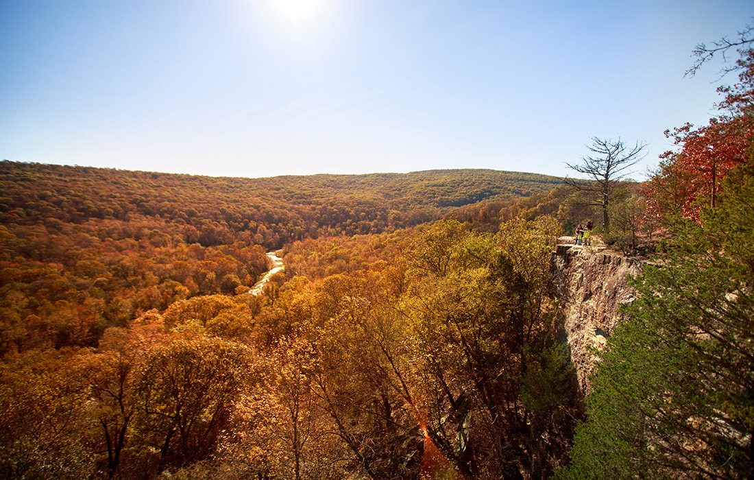
The park’s best view is found on the popular Yellow Rock Trail with panoramic views of the Lee Creek Valley overlook at its namesake rocky outcrop. The semi-loop trail also includes cedar glades, interesting rock formations, tall bluffs and small caves. After a rain you might see small run-off waterfalls.
You can’t miss the trailhead sign located near a campground where parking is easy. From here, the switch-back trail winds uphill, passing layered rocks, bluffs and small caves. About half a mile in, go right at the start of the loop to more quickly reach Yellow Rock and the overlook. The best view of Yellow Rock can be found at a nearby bluff with sweeping valley vistas. (This is a great place for a group photo!) Once you reach Yellow Rock, enjoy another big view. While this trail is used by families, parents should keep a close eye on kids near bluffs and steep drops.
For a complete hike experience, do the full loop and take another spur to the CCC overlook pavilion, the first structure built in the park. The pavilion—and trail—can also be accessed from Arkansas Highway 170. While the park is near enough to visit as a day trip, stay the weekend in one of its CCC cabins to explore more park trails and features.
Difficulty: Moderate
Length: 3.1-mile semi-loop
Location: 2 hours and 45 minutes southwest of Springfield inside Devil’s Den State Park
Time commitment: Make it a full day trip or spend the weekend
Kid friendly: Yes, with caution due to high bluffs; more suitable for older kids with hiking experience
Dog friendly: Yes, on a leash

Goat Trail & Big Bluff
When you float the Buffalo National River and stop to gaze up at Big Bluff – at more than 550 feet, the tallest vertical bluff between the Appalachian and Rocky mountains – you might notice ant-like movement along a high narrow ledge. Yes, those are hikers along the Goat Trail seeking a different kind of Buffalo River experience.
If you can’t do heights, skip this trail. It’s rated moderate as much for the narrow bluff area as for the return-hike incline (take plenty of water and snacks for the trek back up and out). But many say it’s their favorite hike in the upper Buffalo area. The Goat Trail is actually a spur from the Centerpoint Trail, located 3 miles north of Ponca on Arkansas State Highway 43. Follow the Centerpoint Trail until reaching a camping area. The Goat Trail spur to reach Big Bluff goes to the right of a firepit. Until now, the trail has cut mostly through forest. From here along the Goat Trail – so named for feral descendants of early settlers’ goats–you’ll start seeing rock formations as you head toward Big Bluff, about a quarter of a mile away.
At the bluff, an expansive view of the river unfolds. You can stop here or continue along the narrowing bluff ledge, high above the river. (Some people camp out nearby and go back to the bluff for night sky viewing.) Look for century-old Juniper trees clinging to the rocky bluff. Most importantly, take your time: Big Bluff is great place to sit back, ponder the world and soak in the view for a while.
Difficulty: Moderate
Length: 6 miles out and back
Location: 1 hour and 40 minutes south of Springfield, in Compton, Arkansas.
Time commitment: Make it a day trip
Kid friendly: No
Dog friendly: No.
Trail Through Time
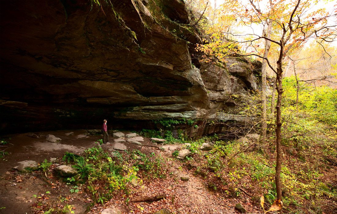
Designated a natural national landmark in 1974, the Trail Through Time in the 256-acre Pickle Springs’s Natural Area features a “geologic wonderland,” according to the Missouri Department of Conservation. Its unique rock formations, outcroppings, seasonal waterfalls, bluff overlooks, shallow caves and more than 250 plant species attract visitors for good reason. Located closer to St. Louis than to Springfield, plan your visit as part of an overnight getaway.
A popular spot for weekend outings, arrive early to snag a place to park and avoid the biggest crowds. Although the trail is roughly two miles long, there is so much to see you will want to take your time. Plus, in addition to well-known plants and wildlife, you may see unusual varieties considered glacial relicts.
The best parts of the trail are the other-worldly geologic rock formations condensed into a small area. They include a double-arch, narrow slot canyons, giant boulders, pass-through rock holes and one popular spot where formations look like something in a space movie. There are plenty of overlook vistas too.
While family-friendly, this is a moderate hike with some steep climbs and rocky areas so it may be better suited for older kids. Also, there are no bathroom facilities on site so plan accordingly.
Difficulty: Moderate
Length: 1.9-mile loop
Location: 3 hours and 45 minutes east of Springfield, near Farmington.
Time commitment: Make it a weekend
Kid friendly: Yes, with caution; may be more suitable for older kids with hiking experience
Dog friendly: Yes, on a leash.
Devil’s Honeycomb
When it comes to evidence that Missouri was home to ancient volcanos, Devil’s Honeycomb—1.5 billion-year-old Precambrian rock outcrops at the top of Hughes Mountain—can’t be beat. The geologic wonder, which you can see for yourself via the Devil’s Honeycomb Trail, is the volcanic aftermath of liquified rocks which, upon cooling, created what’s known as rhyolite formations. In other words: other-worldly rocks that look a little like melted building blocks.
Considered the oldest exposed rock in the United States, that alone is worth the short but uphill trek. But it’s not the only reason. After hiking through forests and glades, the mountaintop panoramic view is gorgeous. Pack a picnic and spend some time exploring the top of this mountain.
The 462-acre Hughes Mountain Natural Area is part of the Mark Twain Forest. Given its distance from Springfield, it might not be worth the long drive to do this trail alone. However, Hughes Mountain is roughly 40 minutes from Johnson’s Shut-Ins and 20 minutes from Elephant Rocks State Park. That makes the Devil’s Honeycomb Trail a great addition to a weekend outdoor outing in this area.
Difficulty: Moderate
Length: 1.6 miles out and back
Location: A little more than three hours northeast of Springfield.
Time commitment: Make it part of a weekend
Kid friendly: Yes, though may be more suited to older kids
Dog friendly: Yes, on a leash.
Black River Trail System
Find a weekend to visit Johnson’s Shut-Ins State Park and the surrounding area, where more than one trail system overlaps, providing a variety of outdoor hiking opportunities at the Black River. The Shut-Ins, of course, are the crown jewel and the trail that loops around them provides several wonderful overlook opportunities to see the clear blue-green water, beautiful cascading falls and large boulders you can clamber on. Named for the Johnsons, a group of early settlers, the park includes a small cemetery where family members are buried.
The Shut-Ins were formed over time by wind- and water-eroded rocks. Changed forever in a 2005 flood, some call the area “nature’s waterpark.” In addition to scenic trail overlooks, the trail leads to areas where you can get in the water to splash, play and slide when it’s warm.
A portion of the trail around the Shut-Ins features a boardwalk. Other sections of the loop trail include a series of stairs, rocky inclines and gravel. In addition, the trail goes through a forest with small glade clearings. There are water crossings in wet weather so plan your footwear accordingly. Although the trail is marked to go clockwise, some trail-users suggest going counter-clockwise so you’ll end up at the Shut-Ins to cool off at the end.
To expand your hike, one portion of the Shut-Ins Trail intersects with the Taum-Sauk section of the Ozark Trail. More of the Black River Trail system continues north of the Shut-Ins, connecting hikers to camping areas, state park facilities and additional trails. While the Shut-Ins trail is family-friendly, portions could be challenging for youngest kids. Dogs are not allowed on the trail, but they are allowed in the park.
Difficulty: Moderate
Length: 2.4-mile loop (around the Shut-Ins)
Location: 3 hours and 15 minutes northeast of Springfield.
Time commitment: Make it a weekend
Kid friendly: Yes
Dog friendly: No.
More Trails for Year-Round Hiking
Check out more trails that are perfect for year-round hiking below.
Written by Savannah Waszcuk, originally published 2019
Fire Tower Trail
Roaring River State Park, 12716 Farm Road 2239, Cassville
Length: 3.75 miles
Difficulty level: Moderate
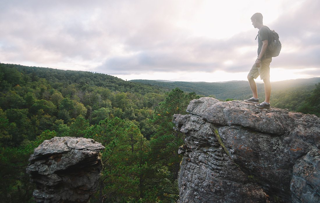
Trail Overview: Danny Collins, Founder and Guide of 37 North Expeditions, recommends this trail for its multiple viewpoints. It leads you through dense woodlands for views of open dolomite glades, springs and streams and a 1930s lookout tower that was constructed by the Civilian Conservation Corps.
Winter Benefits: When the leaves are off, views of and near the tower are on-point. You can see more landscape through the open timbers.
Summer Benefits: Warm weather brings this area an abundance of natural beauty in the form of forestry—a dense setting helps hikers feel a world away from reality. The end of the hike edges the river, which is a welcome sight on a warm day.
West Loop Trail
Two Rivers Bike Park, 5055 Two Rivers Road, Highlandville
Length: 6.6 miles
Difficulty level: Moderate
Trail Overview: Brandi Keltner, a 417-land photographer who is well versed in the Ozarks outdoors, enjoys the versatility of the multiple trails at Two Rivers Bike Park. The West Loop is the longest in the system, and its terrain provides a healthy workout.
Winter Benefits: During the winter there are fewer bikers on this single-track trail, and the lighter traffic provides a more leisurely approach.
Summer Benefits: The length and layout of this trail provide a variety of terrain, including multiple climbs, ascents and even log crossings on alternating rock and dirt terrain. When it’s dry in the summer, hikers don’t have to worry about slippery or muddy surfaces.
Homestead Trail
Ruth and Paul Henning Conservation Area, adjacent to Roark Creek on Sycamore Log Church Road, Branson
Length: 3.5 miles
Difficulty level: Easy to Moderate
Trail Overview: This popular Branson trail in the Ruth and Paul Henning Conservation Area affords hikers views of small creeks and plentiful forest features.
Winter Benefits: Just before the cold hits, the Homestead Trail is at its peak—leaf peepers looking for color come here for some of the best autumn views in southwest Missouri. The trail is also scenic after a fresh snowfall.
Summer Benefits: Collins notes that this is a great trail to meander after a heavy rainfall—the small creeks overflow and dot the path with hidden waterfalls, and you’re always within earshot of running water.


